
sunlight basin explorations
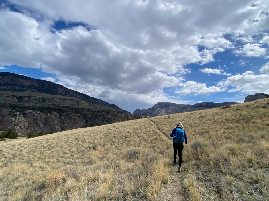
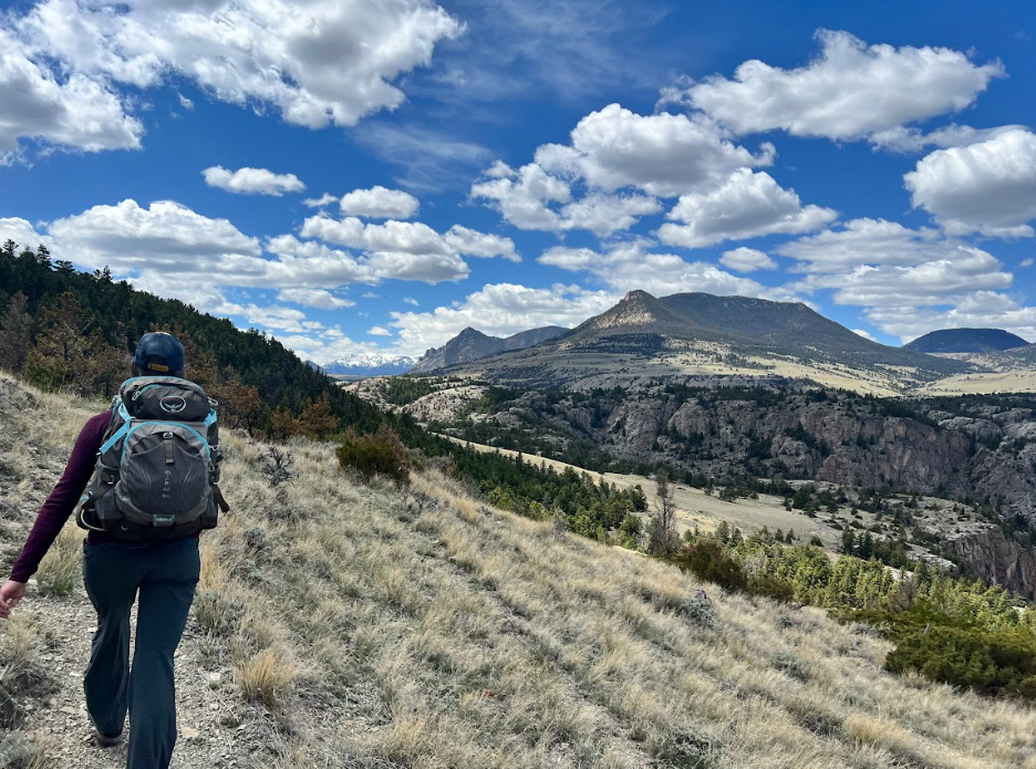
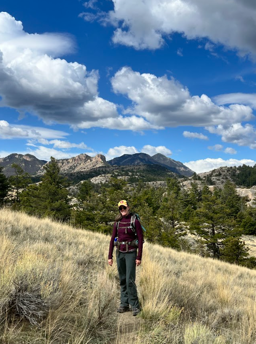
Wolverine Whisperer and I hit the trails together now that the snow has (mostly) stopped falling and spring hiking spots allow our longer trail wandering dreams to come true.
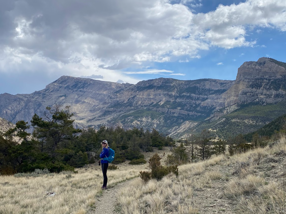
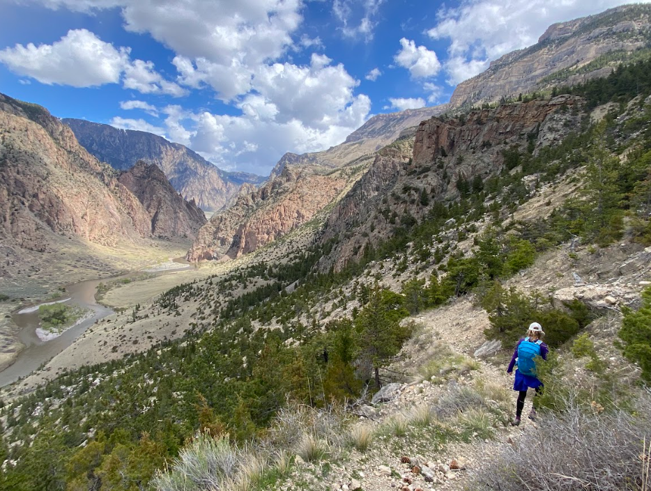
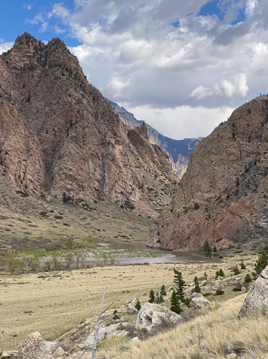
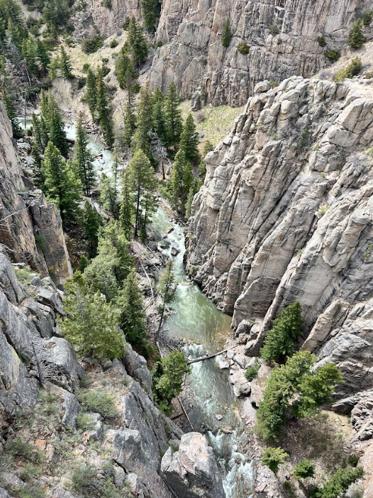
POV: Looking north into the Clarks Fork Canyon from Dead Indian Trail in Sunlight Basin, Wyoming
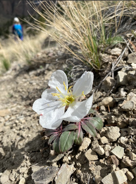
Sunlight Basin in northern Wyoming is an apt location for spring hikes where the snow melts out early leaving you capable of hiking longer trails that include jaw dropping views all to yourself (but watch for bears so maybe don’t go alone). For our 10-mile trek along Dead Indian Trail, the warmer climate also provided an abundance of wildflowers. The only wildlife we encountered were birds, bunnies, and bugs.
A bit of history first before the nitty gritty on what we experienced: Dead Indian Trail is found along the escape route of the Nez Perce when Chief Joseph led the party from Oregon to Montana in 1877 while being pursued by the U.S Army. The name, Dead Indian, stems from a tale of an Indigenous warrior being injured and left to die in this specific location. For more information, check out the National Park Service site detailing the Flight of the Nez Perce.
Wolverine Whisperer made a comment of concern that the name remains despite recent efforts to be more conscientious about names, appropriation, and land repatriation. I, too, wonder how to better commemorate the loss of life and the harrowing journey of the Nez Perce through this area.
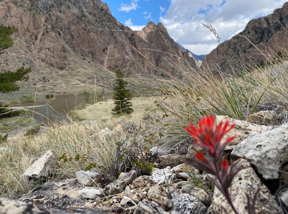
Paintbrush found along the trail
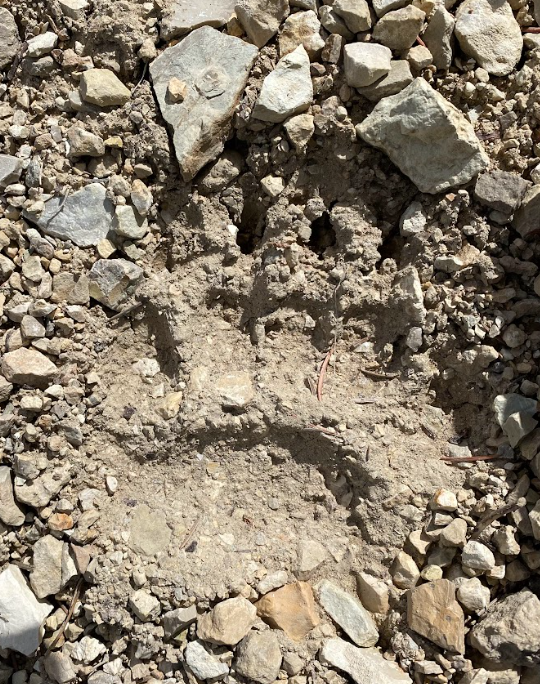
On a lighter note, the perfect spring day buoyed our spirits and we felt at ease with the world alone in nature, exploring together, chatting about life’s woes and throws in equal measure to elations and revelations. Our conversations interspersed with loud shouts and claps to inform bears of our movement through their territory. We only saw bunnies through the forested sections of trail and birds flying around the open range grassy bits. Although, upon descent into the canyon to the river, we discovered black bear prints in the silty pea gravel and began to shout more loudly and more frequently despite the heat of the sun on our backs.
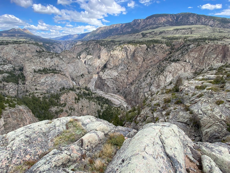
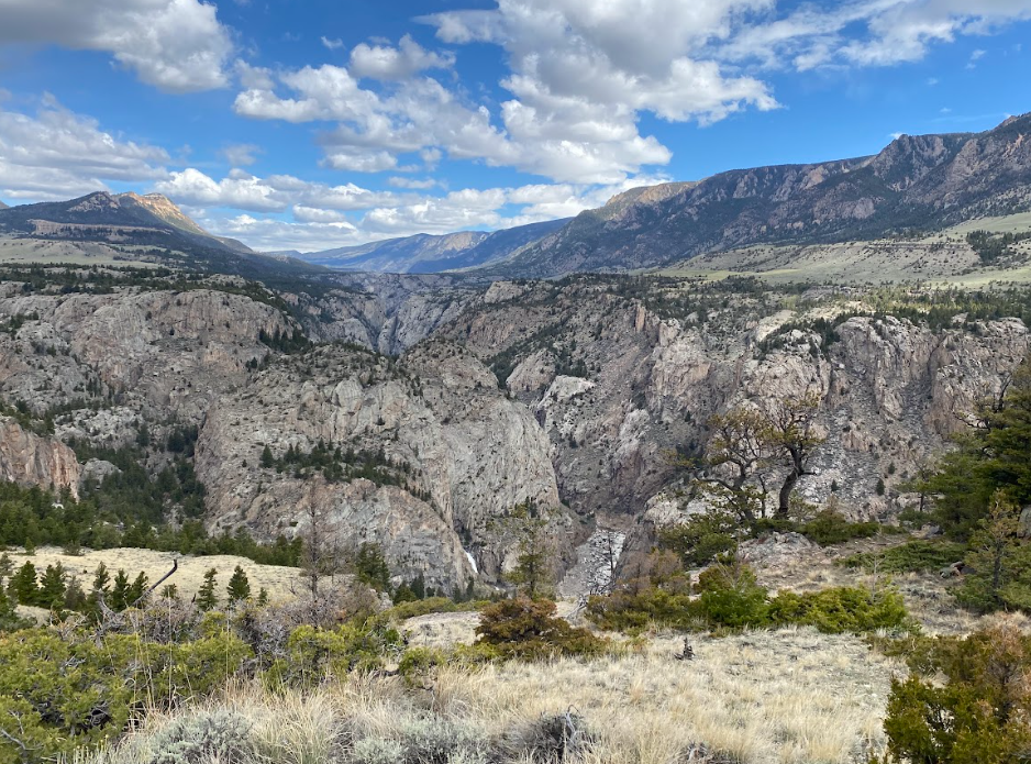
Canyon overlook of waterfall
Halfway to the canyon, an overlook shows off a massive waterfall and stunning canyon views. The overused phrase “pictures don’t do it justice” rings true and accurate here. I took multiple shots hoping for something to turn out well enough to share with you.
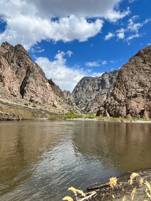
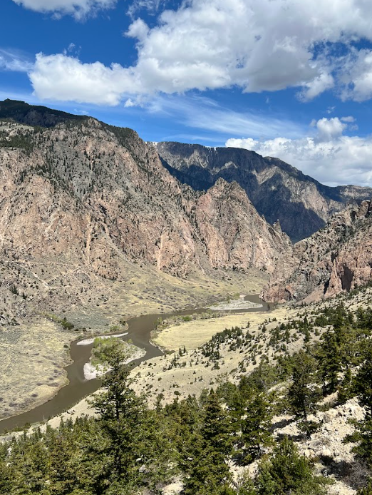
Photo credit to Wolverine Whisperer for this river bank image!
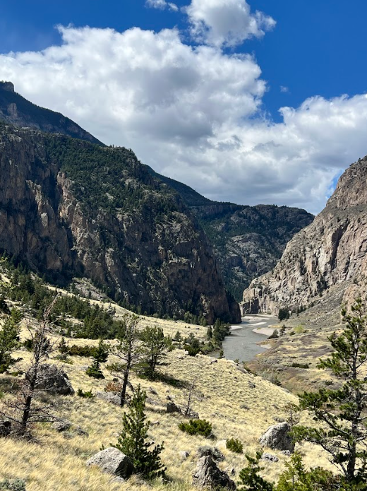
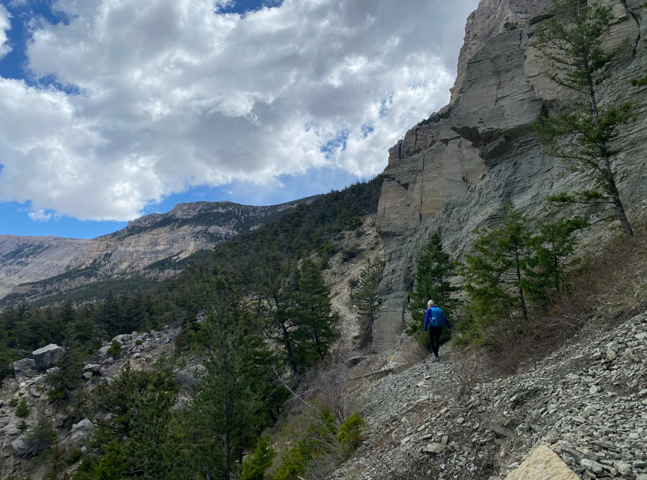
Most of the trail is flat-ish, or at least you can’t determine whether you are rolling slightly up or down. Mostly you roll down to the river, where we enjoyed lunch and a quick break along the bank. The steep sections back out of the canyon are short at least and the switchbacks easy to navigate. Since you climb on the return trip, the 10 miles feels very short.
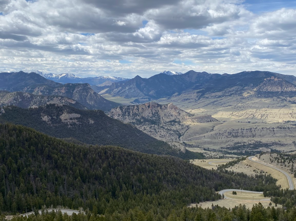
Afterwards, we drove the short distance to the Sunlight Creek bridge where the dizzying drop into the canyon awes your senses. Then, we flipped back towards home and stopped at the top of the switchbacks of Chief Joseph scenic byway for the most epic view of the Absaroka Beartooth range. The brisk wind made it a short stop otherwise we could have gawked endlessly. I’m willing to bet you could too. On we went, munching our carefully selected post-hike road snacks and chattering about summer adventure ideas basking in post hike bliss.

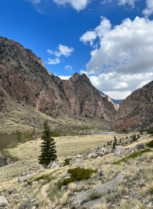
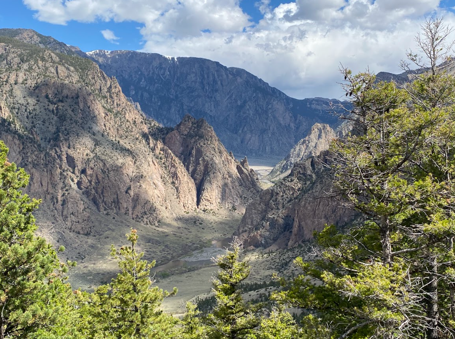
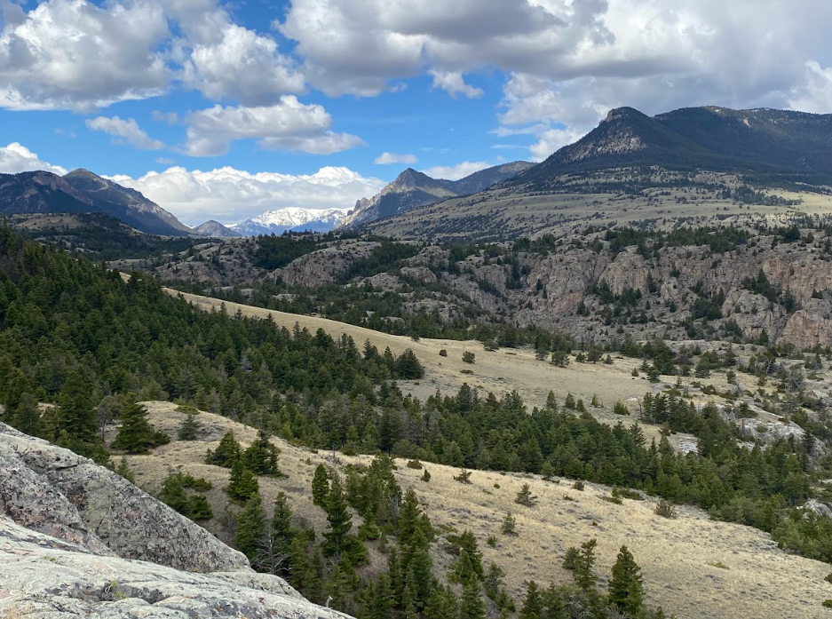
The above carousel of images shows off the scenery along the trail and includes rocky canyons under blue skies, wildflowers, distant snowcapped mountain ranges, and close ups of the brown murky river.
Scenes from the Chief Joseph Highway
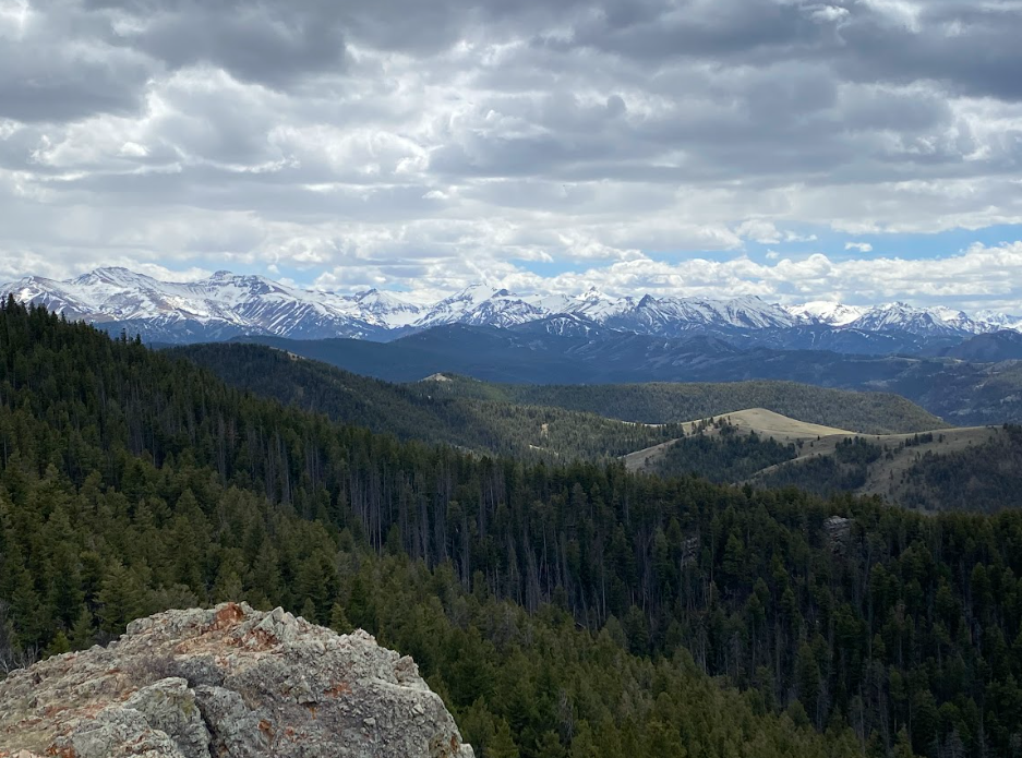
Absaroka Mountain Range
Sunlight Basin
POV: Sunlight Creek from the bridge
During the hike, I lamented not driving a friend along the Chief Joe scenic byway to share these inspiring views during her October visit. Next time, Slizzle! ;-)
This highway makes a grand loop from the famous Beartooth Highway or can be enjoyed while it is closed. Both are bucket list life items!