
WYO BDR Explorations
BDR = Backcountry Discovery Route; These are driving routes created for adventure motorcycles, or rigs that are off-road adventure worthy, and can be found mainly across western states. For more info, check out https://ridebdr.com/.
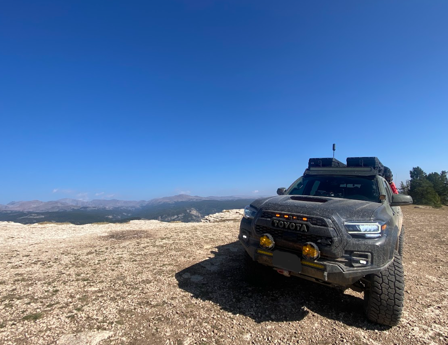
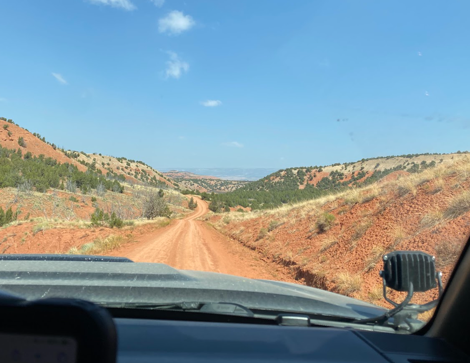
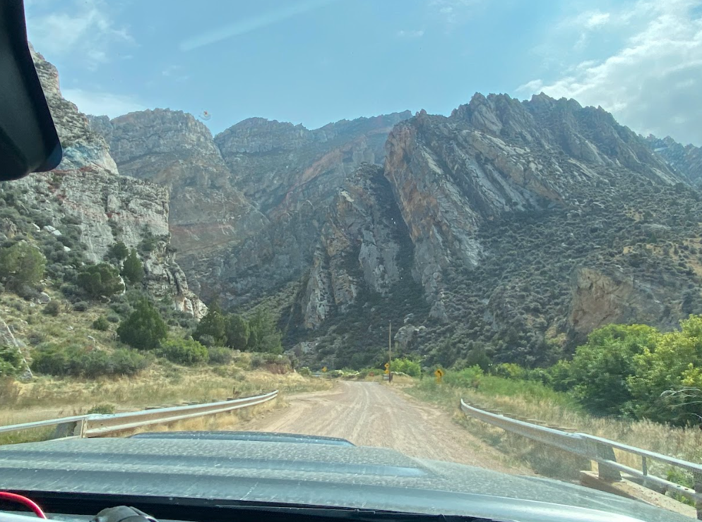
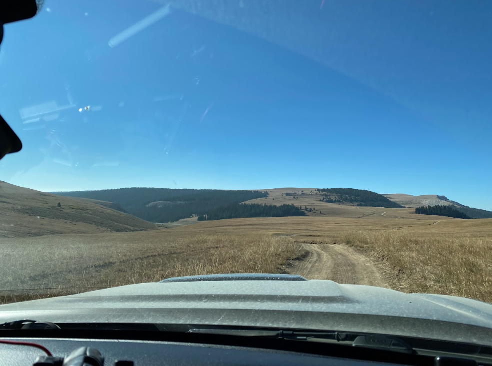
Trigger in action
TAJ and I tested out Trigger, our truck, across the Wyoming route and discovered unexpected ruggedness and wildlife in ample supply. We generally drive these routes more quickly than recommended to determine which locations are worth a deeper exploration at a later date.
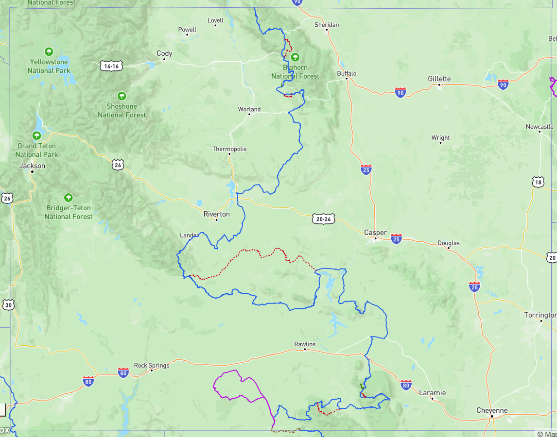
It’s recommended to drive each state route from south to north and the sections are numbered to suit that direction.
Meandering across Wyoming in a serpentine direction allows one to brush against as many mountain ranges, deserts, and forests as possible within eight sections.
Day One - Home to Red Desert
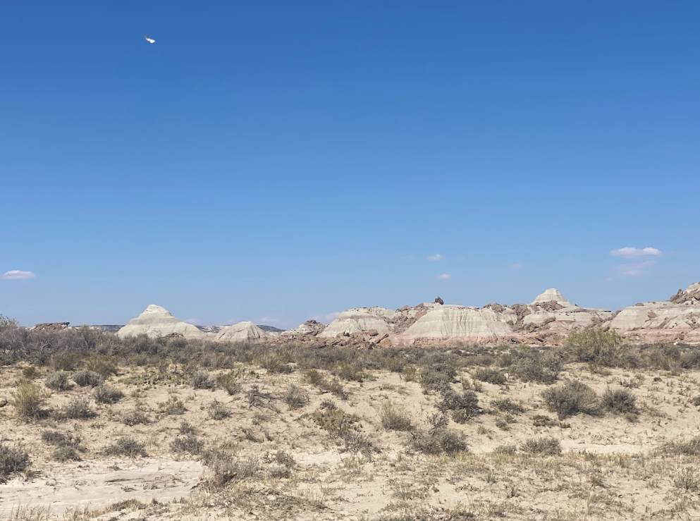
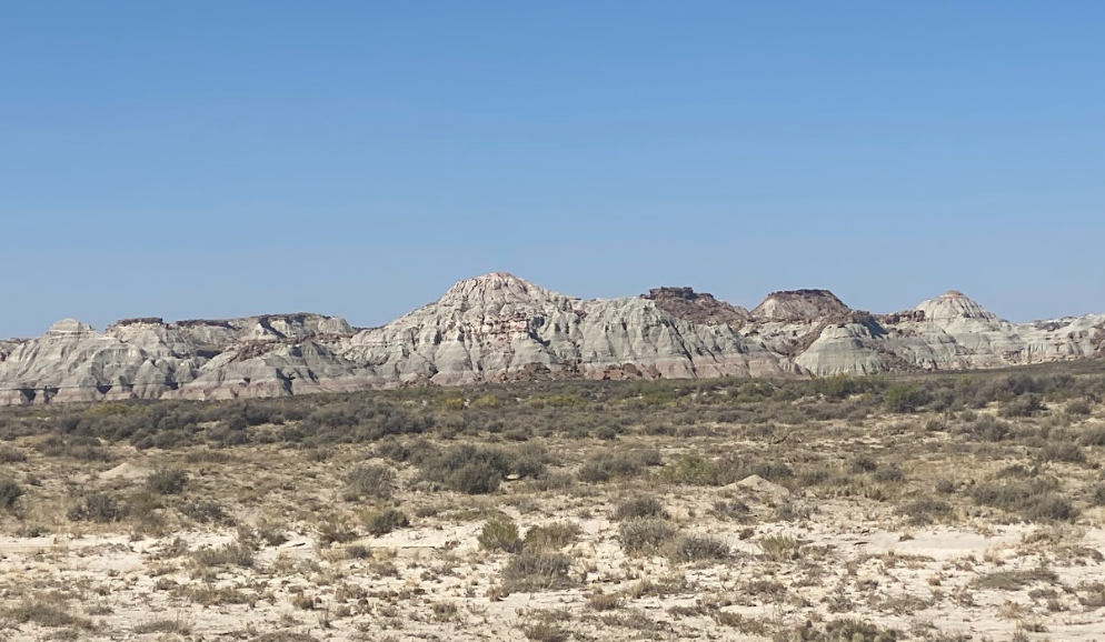
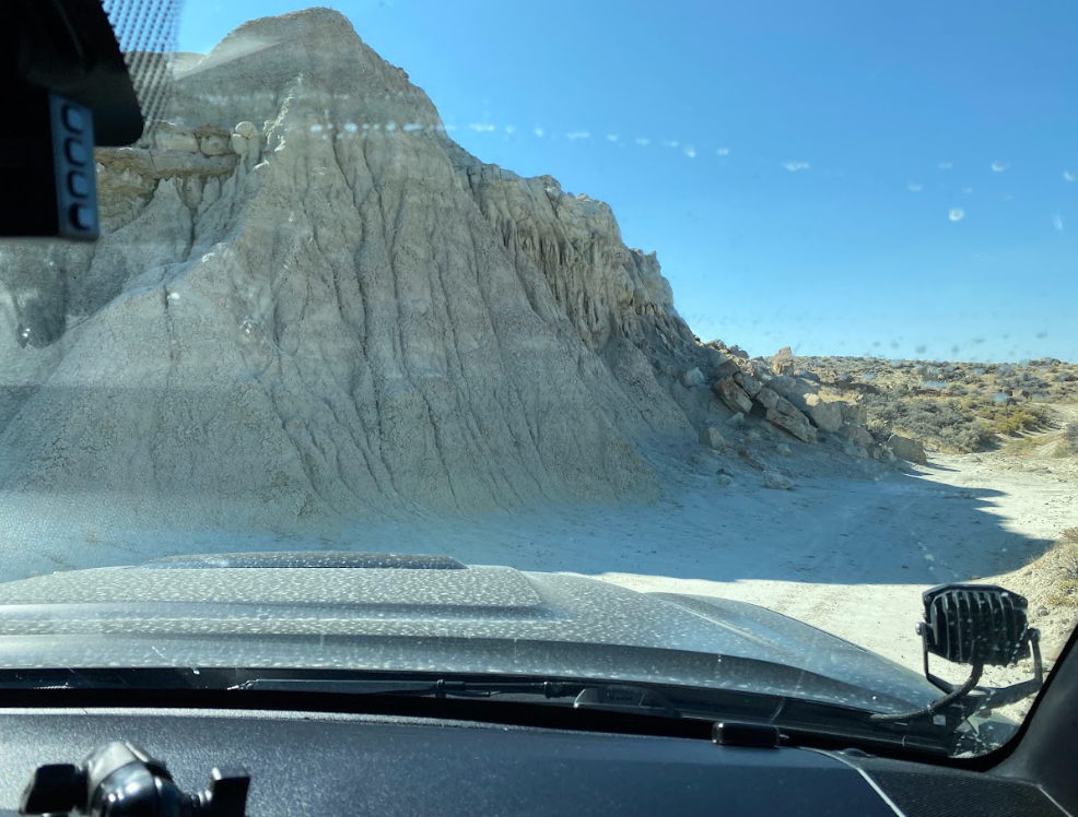
We left our home early-ish to drive down and complete the extra loop titled Red Desert before staying overnight in Baggs, the official start of the route. In the high desert of southwest Wyoming TAJ and I found a surprising abundance of wildlife. From wild horses to coyotes, every sighting awed and inspired me. We also drove through crumbling rock formations dubbed Adobe Town Geologic Area and passed the ruins of Fort LaClede.
Day Two - Baggs to Medicine Bow
Section one
Baggs to Centennial: 161 mi
Beginning the day on a catwalk of a hillside, we soon meandered through aspen forests in the Medicine Bow National Forest. Although I missed our turn and we missed an incredibly large swath of this section, including Bridger Peak (11,004 ft), we happily admired the views we experienced and carried on to Encampment. Along the way to Centennial, we stopped at Rob Roy Reservoir so I could stretch my legs. Later, we paused for three big horn sheep to cross the road before rolling into the tiny town of Centennial.
section two
Centennial to Elk Mountain: 68 mi
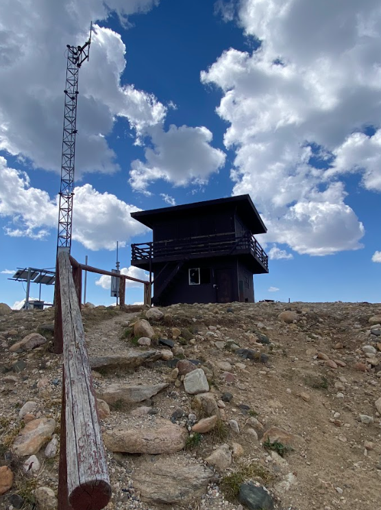
Kannaday Peak fire lookout tower
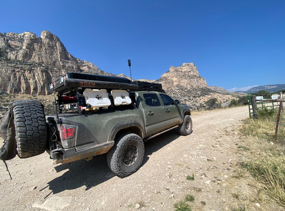
Centennial didn’t offer much as far as towns go so we continued on with plenty of daylight to complete another section. I led TAJ out to see an extra point of interest, Kannaday Peak, which boasted a fire lookout tower viewpoint. The long, rugged fire service road didn’t seem worth the extra mileage so I took artsy photos of Trigger to make up for the side quest.
Despite planning for camping in the pop-up tent on top of the truck, we were so close to Medicine Bow that we decided staying amongst amenities for the night would be easier than finding somewhere to camp. The historic Virginian hotel put us up in their Owen Wister suite and spoiled us. I, of course!, savored the history of the place, reading all the notes, admiring trinkets and photos on the walls. I think we were the only guests in the hotel that night so the ghosts left us in peace.
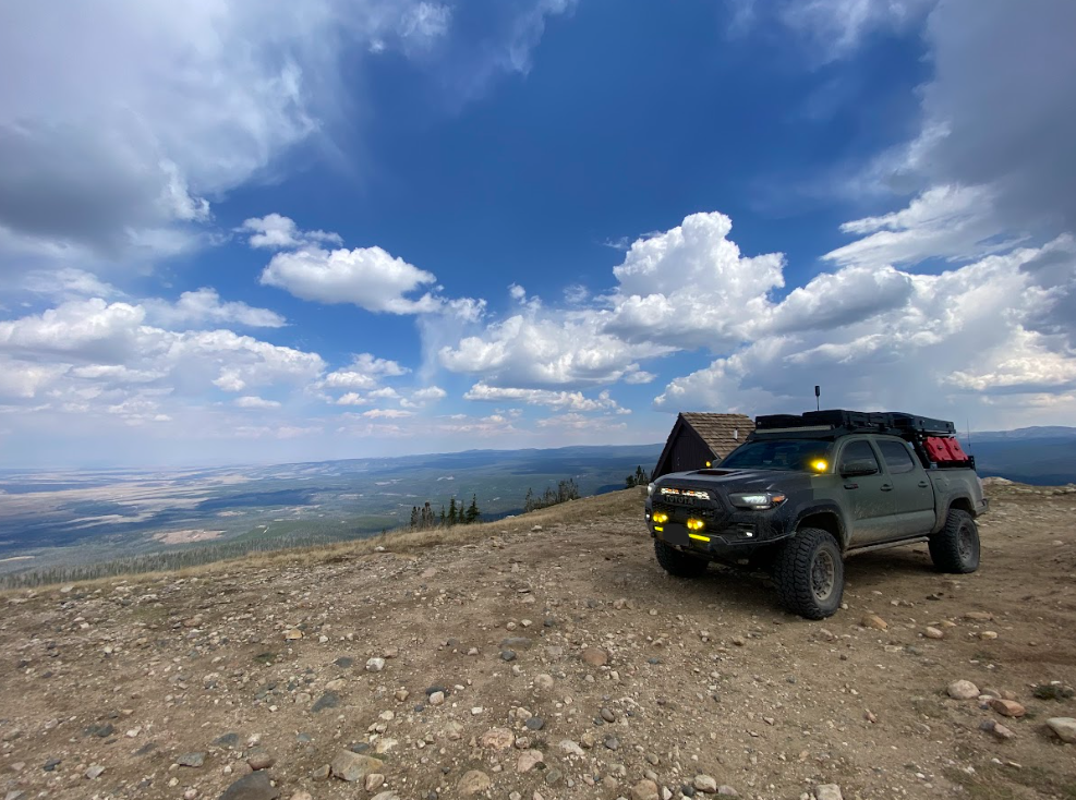
Artsy photo of Trigger
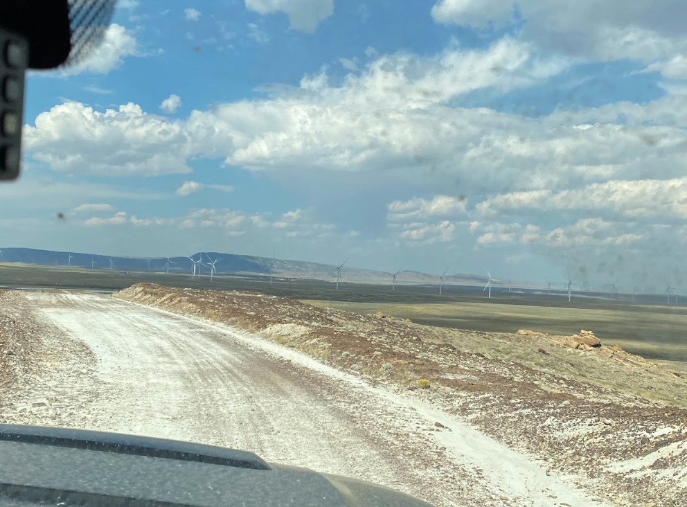
Just before arriving at the town of Medicine Bow we passed through the ruins of the first mining town of Wyoming, appropriately named Carbon, only to find modern windmills on the other side. Wyoming offers titillating contradictions.
Day three - Medicine bow to Casper
section three
Elk Mountain to Alcova: 122 mi
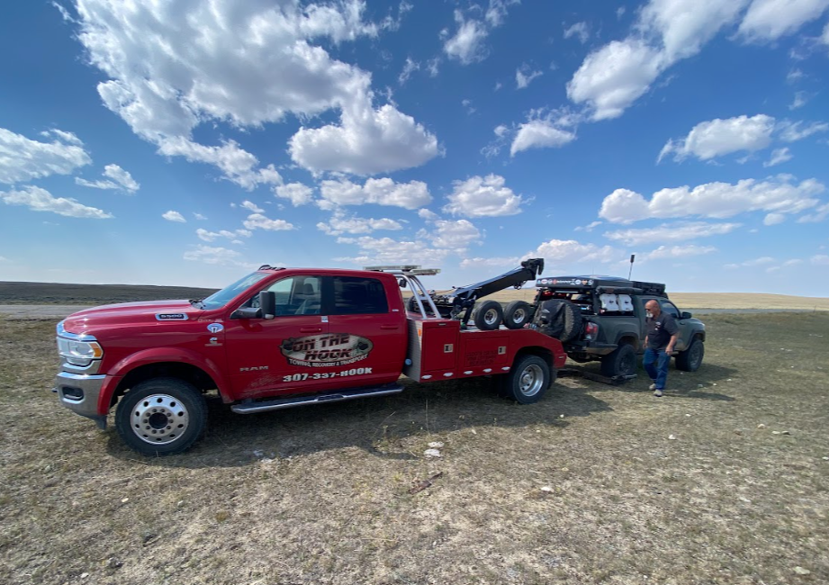
We set off with bold plans to knock out another two sections despite the warning on the BDR site that section three is long and arduous. By the time we topped the Shirley Mountains I noticed the camper swaying back and forth heavily above the truck bed. We hopped out to tighten bolts and screws only to discover that many were completely missing. We bailed asap. First though, I held my breath and couldn’t wrench my eyeballs away from the mirror during the five miles towards the main highway.
Relief = on our way to Casper to buy bolts and check the suspension. Oh right, I didn’t mention Joey hitting a rock while trying to pull over for a fire engine because I didn’t want to rudely call him out. However, I forgot that adds some foreshadowing here. A herd of antelopes (yeah, I know they’re actually pronghorns but antelopeeees is my fun version so let me have it!) darted across the road in front of us. Slamming on the brakes, TAJ had judgmental words to share towards the animals.
Then, we began to coast down a hill as he tested the brakes and found them to be softening. Which you may now interpret as a complete lack of braking ability. Well, here we are—the most exciting portion of the trip. The most worried about happenstance on any off-roading adventure. I also did not mention the necessity for being able to attend to your vehicle if anything goes awry. A severed break fluid line, however, cannot be amended on the side of a road. Thus, a tow was summoned. Aren’t we the luckiest for this occurring an easy 50 miles from Casper? Yes, indeed.
In fact, I thoroughly enjoyed my lunch by the side of the road with the free range cows. I read in the sunshine as the wild wind whipped our clothes. AND I made sure to take “cool” pictures as directed so as not to miss the biggest adventure of all portion of our trek. You’re welcome, TAJ.
day four - Casper to Lander

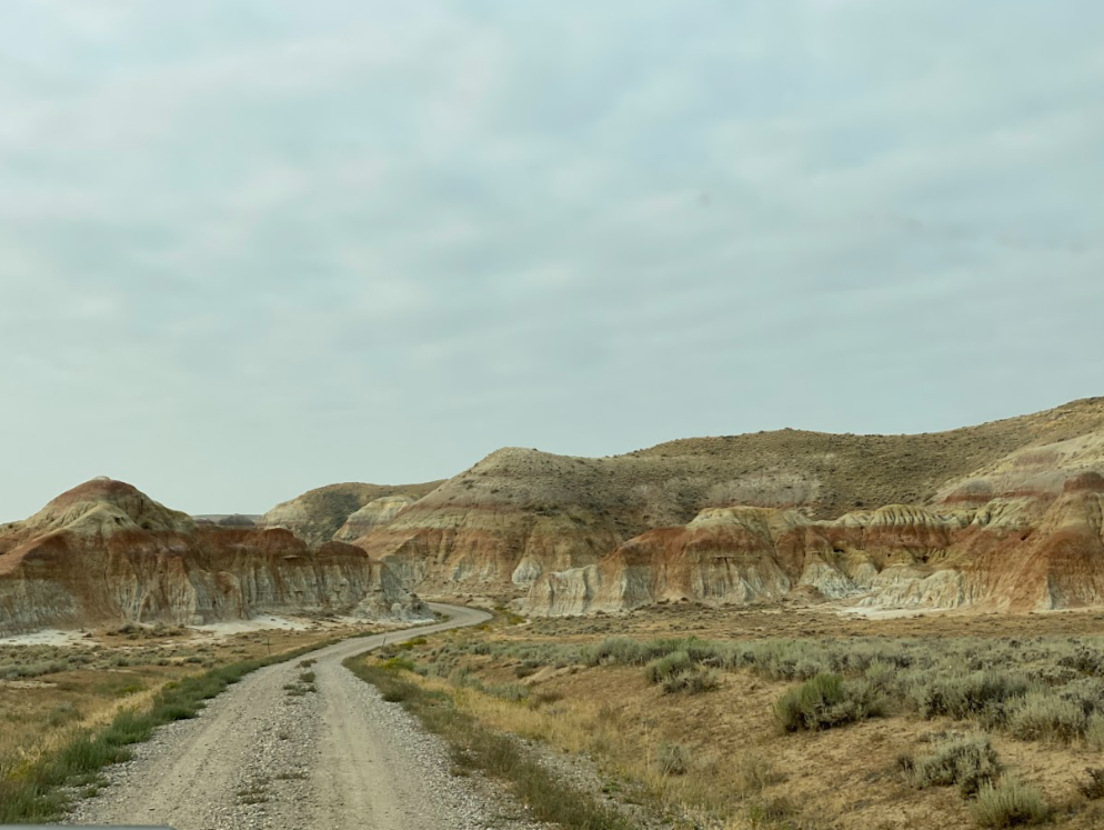
section four
Alcova to Atlantic City: 163 mi
Honestly, the morning in Casper was a delight. I gave myself a ballet barre in the hotel room, read in the sunshine while the wildfire smoke creeped into town, and soaked my legs in the hot tub until Trigger was all fixed and ready to continue. What a great hubby to take care of it all while I could R&R. Thanks, TAJ!
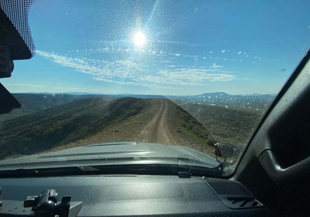
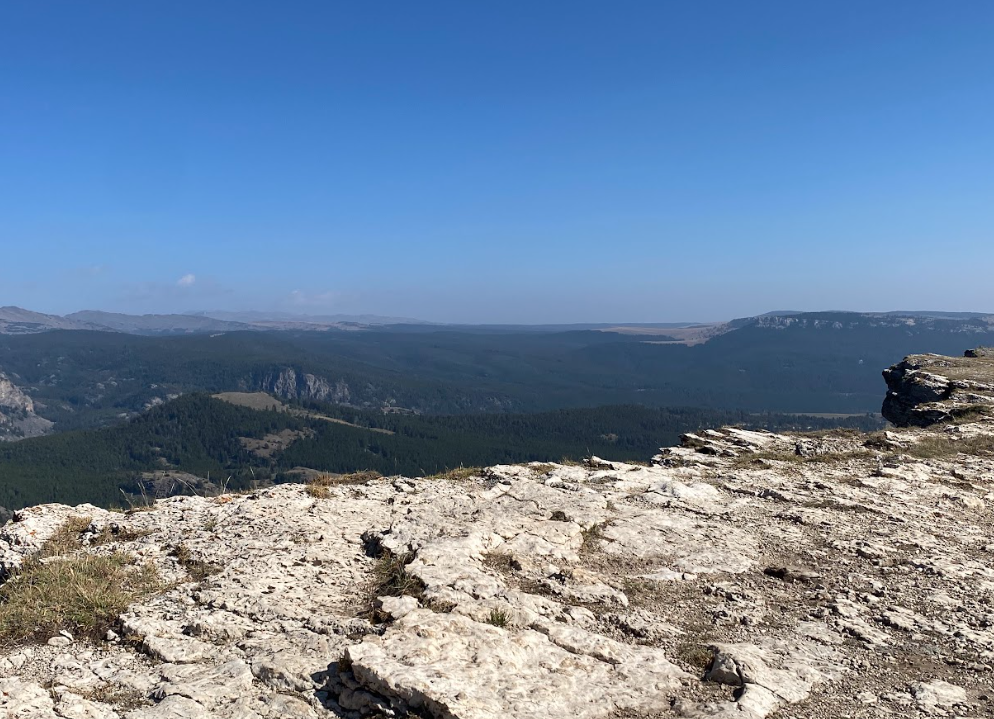
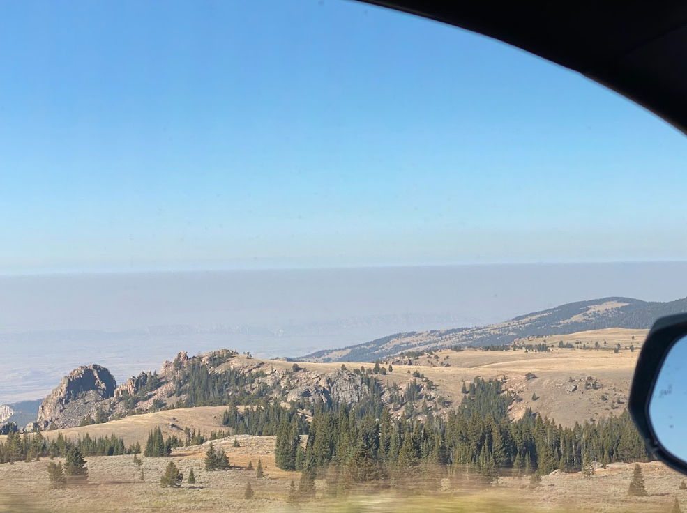
Then, we proceeded to the route. Quickly we learned how unexaggerated the description of a long and arduous day the BDR website description proved to be. I took one photo. With the wildfire smoke thickening and the need for me to read a paper map (read: much arguing and grumbling) rather than the fancy BDR website colored line interactive map that requires cell service, I simply didn’t think pictures could capture the cool rock formations beyond the ridges we teetered along.
After too much sage and desert for TAJ, he wanted to skip ahead to Lander and stay the night at the Shoshone Rose. His affinity for staying and eating at casinos baffles me but I play along. We don’t gamble but the Southern Baptist heritage in me can’t seem to stop gawking. I enjoyed an Indian Taco instead and relished the swanky, beautifully decorated hotel room despite my sadness to miss the Wind River range, the range I was most excited to finally explore.
At this point can you tell who drove the entire time? Although I was informed I would be doing much of the driving, I ended up only allowed to drive the paved sections. It wasn’t that rugged, y’all! Ok, granted we did lose a lot of bolts demonstrating the severity of the rocky FS roads and we opted for the alternate “HARD” section along Beaver Rim but still, smirk. At least there were wild horses to watch out the window.
section five
Atlantic City to Shoshoni - 130 mi
Day Five - Lander to Burgess Junction
section six
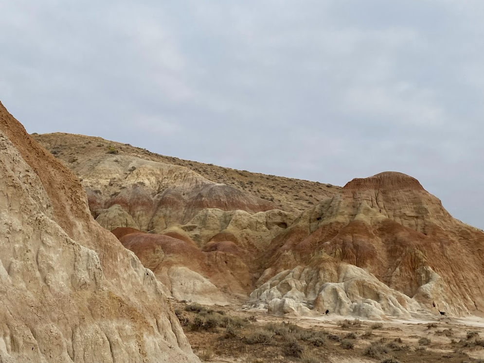
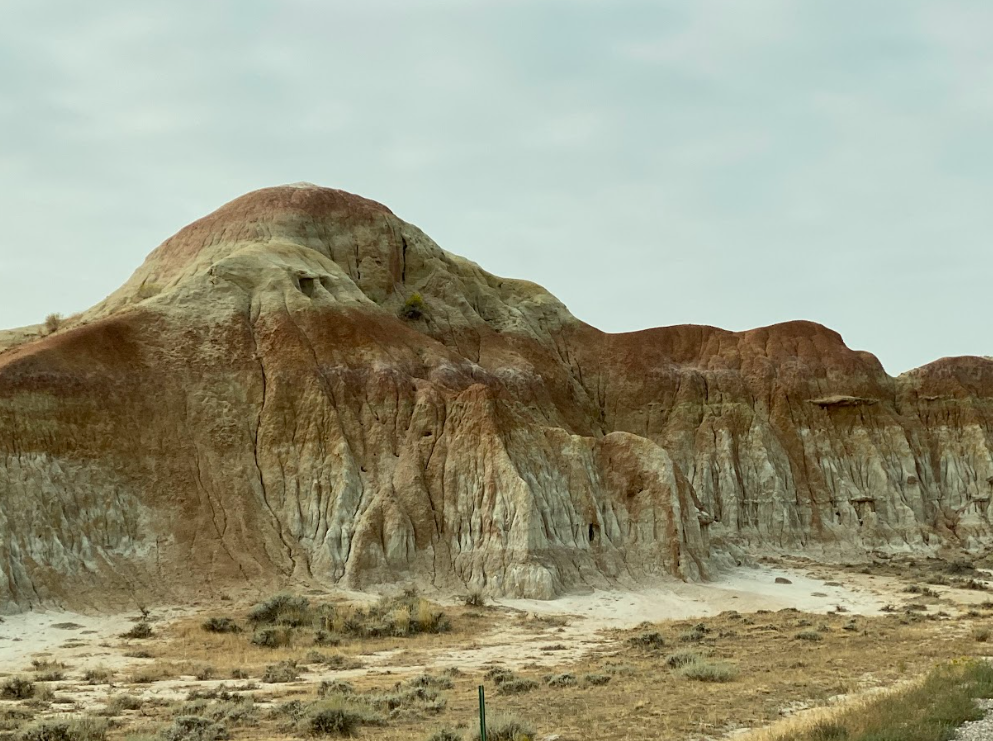
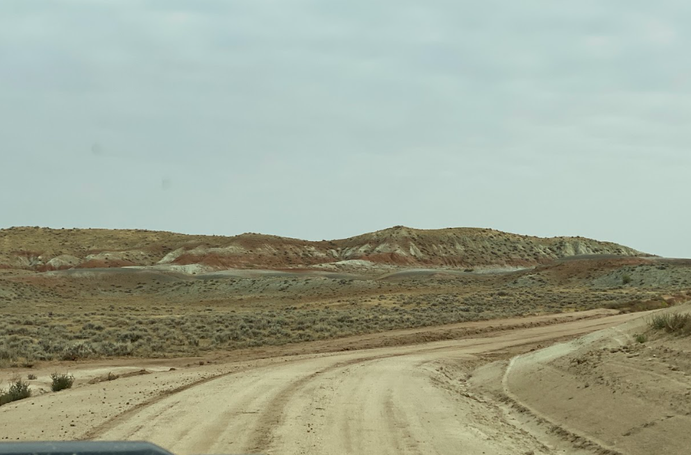
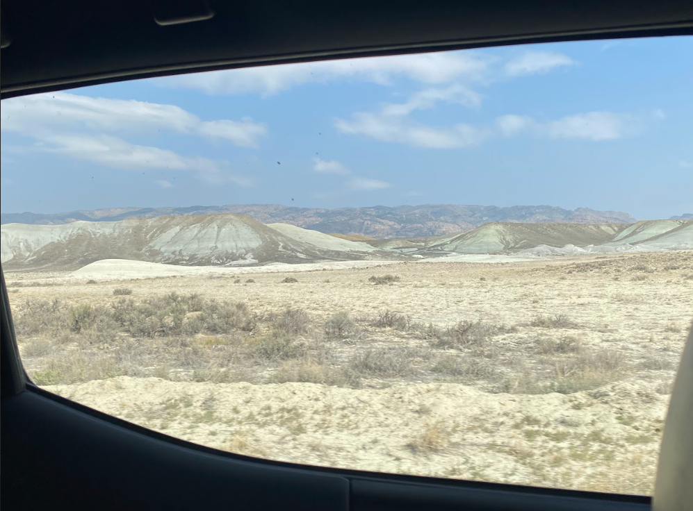
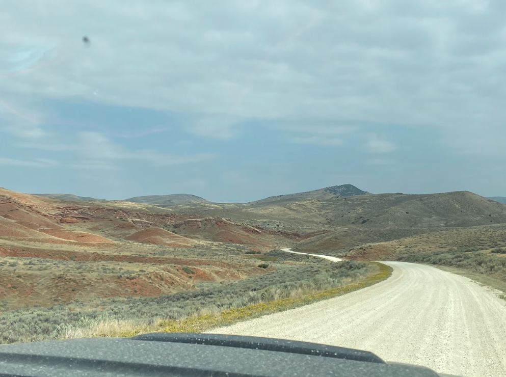
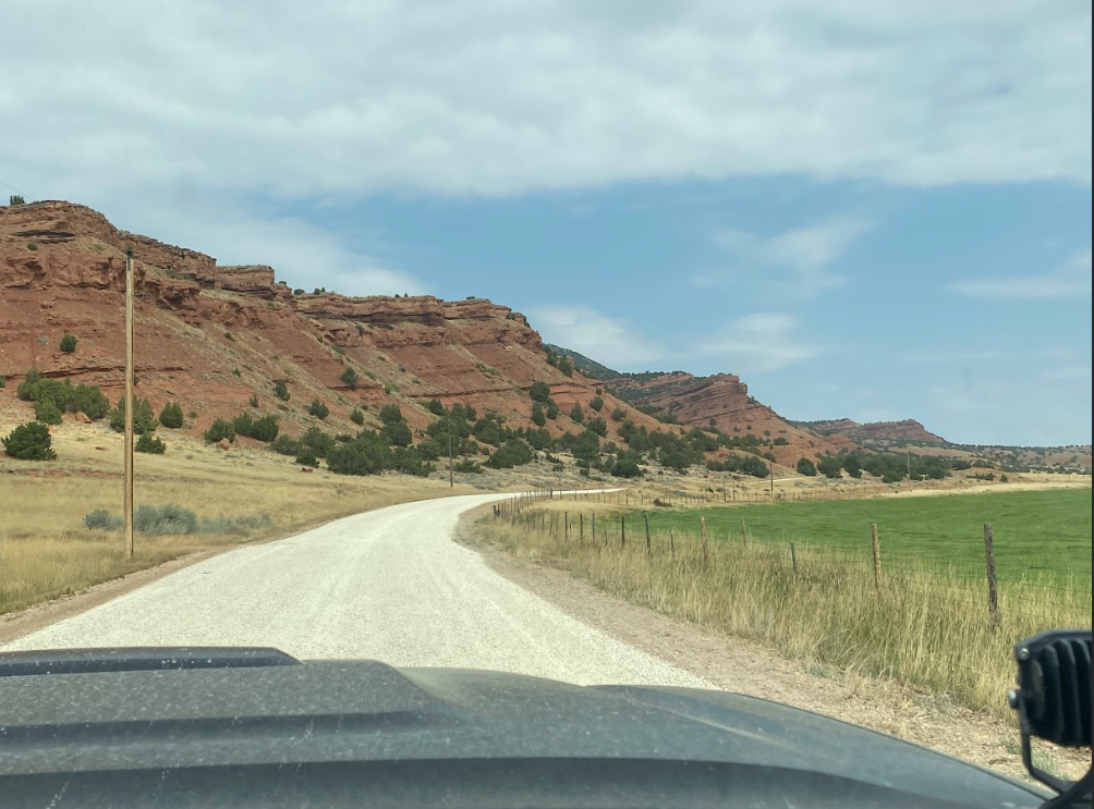
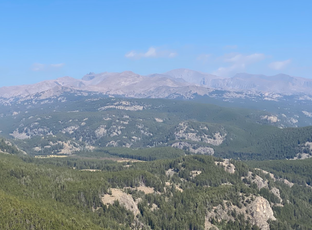
Shoshoni to Ten Sleep - 104 miles
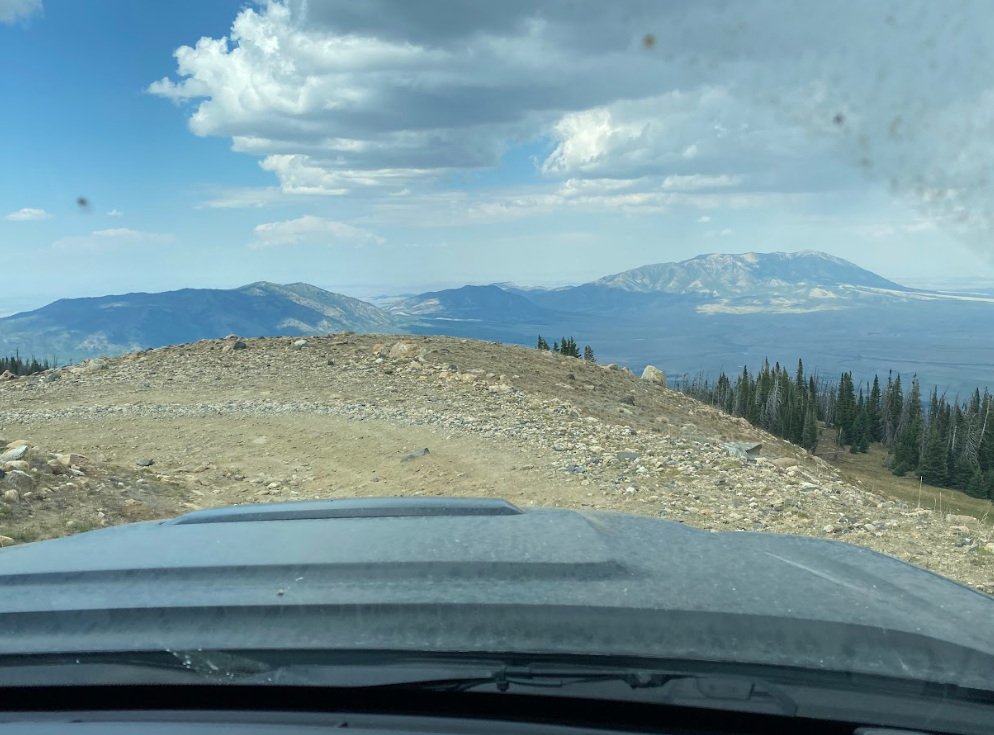
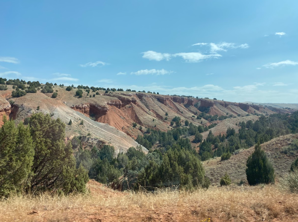
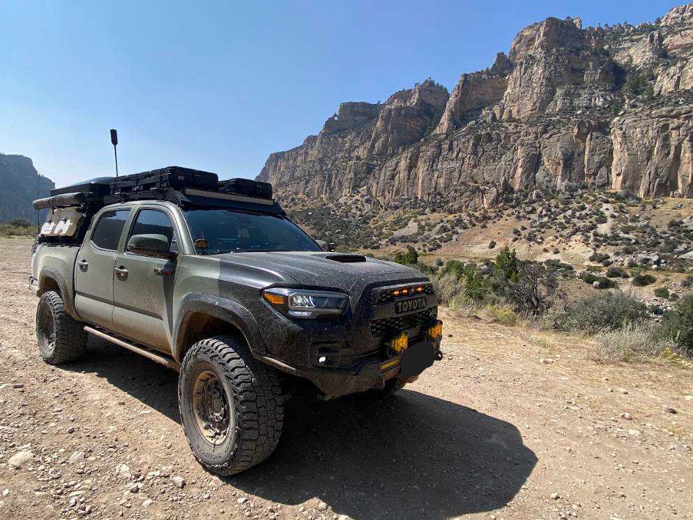
I took the most pictures between the old mining sites and Ten Sleep. The rolodex below proves it. My disbelief in the variations of landscape within mere miles caused my finger to snap pics wildly on the scenery unfolding out the window. From rainbow cliffs to green pastures overtaking red dirt hills, the uniqueness doesn’t stop. It’s been on my list to explore the Big Horns and Cloud Peak but now I’m moving it up the list!
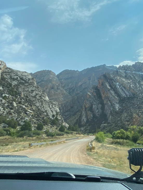
After a fill up and short game plan decision making convo in Ten Sleep, TAJ and I headed into the heart of the Big Horns. We planned to find somewhere to not camp since the impending freezing temps overnight would not be as comfy as we wished. After a tricky time figuring out where Burgess Junction was (a mere intersection not a town) we discovered every location happened to be booked up for the night.
Without cell service we risked driving around the corner to another lodge and lucked out with an available room in their cabin. The next morning we spotted many moose along the roadside while blasting the heat in the truck. The moose seemed to be fond of the cooler temps as the sun rose and melted the frost into steam. Picturesque and idyllic scenery to behold!
Section Seven
Ten Sleep to Burgess Junc.: 116 mi
Day six - Burgess Junction to home
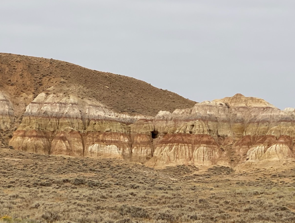
Section Eight
Burgess Junc. - MT border: 43.2 mi
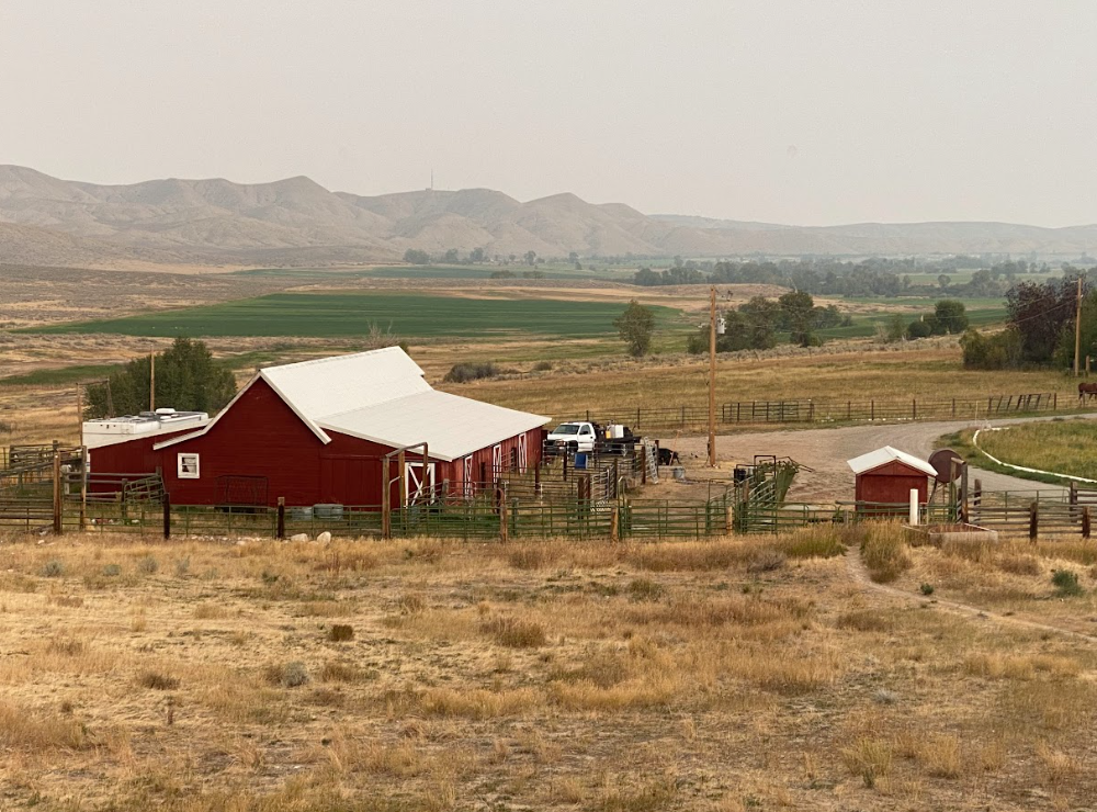
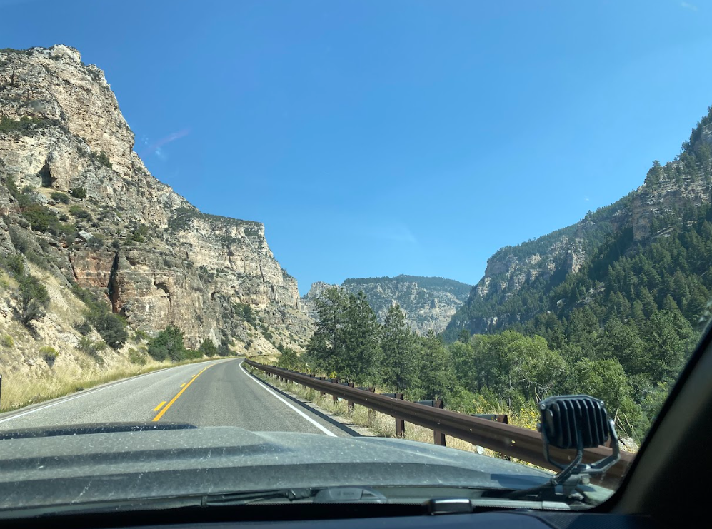
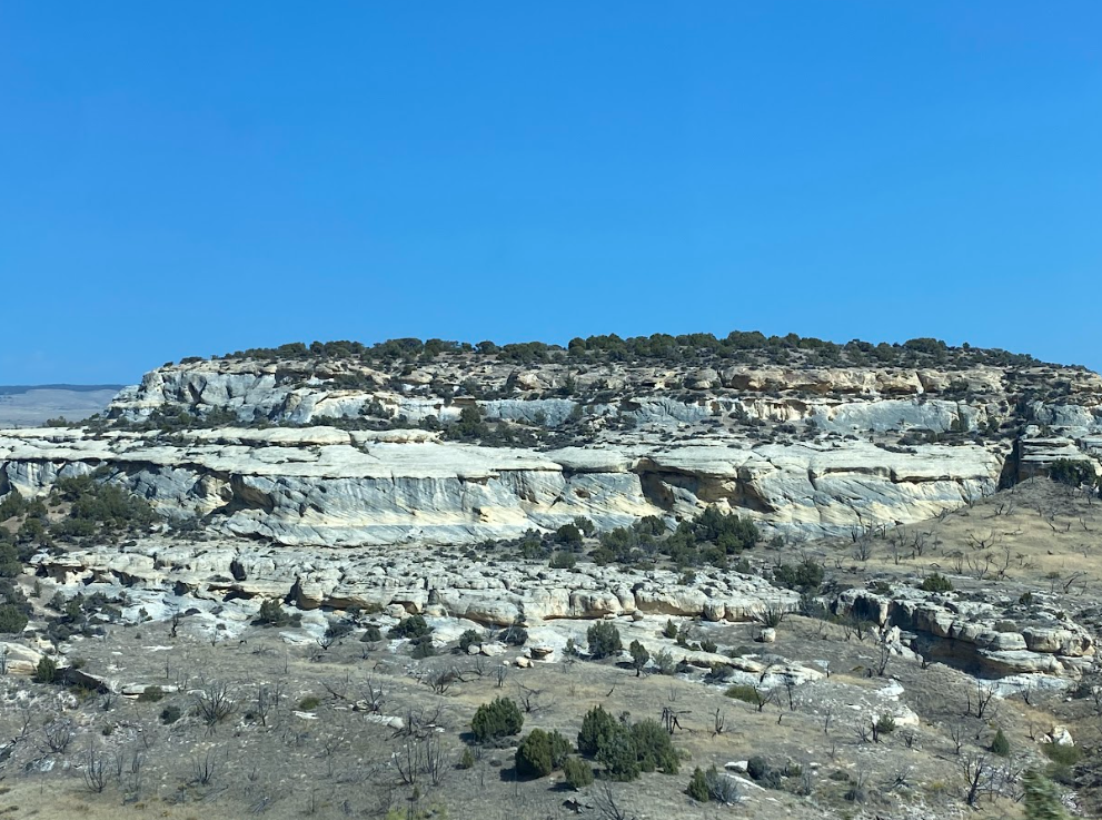
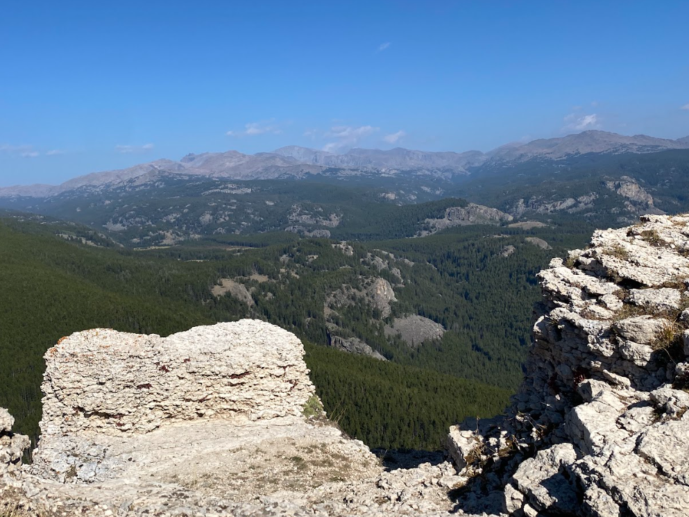
We skipped this section! But I gave you a picture of coming out of the Big Horns anyway. I imagine it’s a fun, rugged section that is hardly traveled and hope we return to explore it in our side by side one day. And by one day, I mean this Fall!
What about you—do you off-road? If so, what routes do you recommend? If not, is it something you are interested in or terrified to try? What other summer adventures did you experience for the 2025 season?